Monday, August 10, 2020

Day 10 - We came, we saw, we slot canyoned

Last day of vacation – part sadness, part joy at getting back to air conditioning, a shower and a bed, although not necessarily in that order.  We said goodbye to the Hoodoo Hollow and drove to our last attempt at a rockin’ slot canyon – Little Wild Horse Slot Canyon near Goblin Valley.  Having not had any regular cell service for days, I didn’t have a chance to review details about Little Wild Horse, so we didn’t really know what to expect.  We had camped only about a 5-10 minute drive from the trail head, so we were on the trail by about 8:30.

Little Wild Horse offers two options – one is a 4.5 mile out and back through the slot canyon and back; or, if you keep going, there is an 8-mile loop that also includes Bell Canyon.  

Cool Tree

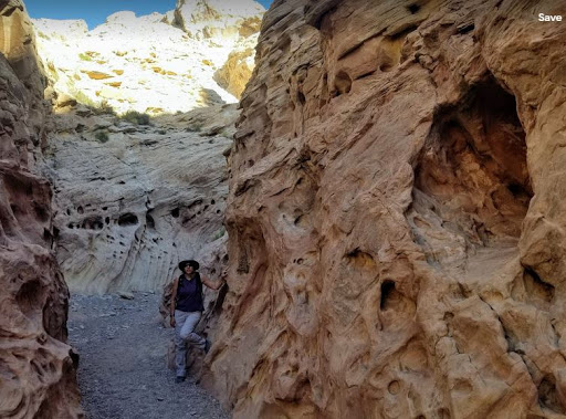
We opted for the shorter hike since, you know, hot desert, etc.  About a half mile in, the canyon started to close in and  we were in a very narrow slot fairly quickly.  This was a surprise since all our other hikes required at least 2 miles before getting to anything interesting.  Little Wild Horse made up for all of the disappointing slots from earlier in the week – it was completely shaded almost the entire way, it had narrows and doable climbing spots, it had fun swirls and holes and patterns in the walls – literally everything we were looking for – and it went on and on and on.  


This is what it looks like walking through a slot canyon:


AND, because we did the out and back route, we got to do it twice!  

Fun wall climbs

More fun wall climbs

On our way back, there were a few spots where we could hear people coming and the path was so narrow that we either had to climb, backtrack, or try to find a spot that was wide enough for someone to pass.  All around awesome hike for our last one.

After finishing LWH, we drove about 10-15 minutes to Goblin Valley, which was an interesting area filled with stumpy brown mushroom shaped hoodoos that looked like a bunch of little goblins. 


This area didn’t really have much in the way of designated hiking areas, it was more about dropping into the goblin valley and wandering among them.  Plus, no rules against climbing on them.  So, we did.  The goblins made for a great game of hot lava jumping from one to the next until Damon miscalculated.  Game over.  

Having finished the last item on my long list of hot spots, our vacation is pretty much over. 

We drove straight to Denver after Goblin Valley to hang with friends before heading back to Chicago and had the opportunity to spend a short time at Garden of the Gods with them.  Shout out to Melissa who really wanted to be mentioned in the blog 😊


And with that, another Monkeyhouse Adventure comes to an end.  Until next time...

Day 9 - Good Graffiti and the Hoodoo Hollow

Last night was a chilly one, but in a good way – I got to snuggle in my Sherpa blanket and stay in bed until 7am.  As the sun came up, the view from our tent was, once again, just gorgeous.  

View out the back from inside the tent

Side note:  Damon is a big fan of off-road camping; he has a bunch of maps that tell us which public lands allow camping, basically anywhere.  While they are typically “campsites” and often have some type of fire pit, that is about the extent of the luxury.  Everything you need, you bring.  On the plus side, there is NO ONE around and the views can be extraordinary if you find the right spot.  Oh, and they are completely free!

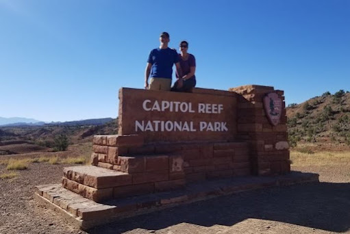
We had a leisurely morning, made breakfast, and rolled out of camp around 8:30 to explore Capitol Reef National Park.  


Capitol Reef is definitely a lesser known of the major National Parks in the area, but the benefits include very few people and some of the most spectacular views I’ve ever seen – and we have hit nearly every National Park in the area, some multiple times.  Capitol Reef is all about towering red rock cliffs, the brightest blue sky you’ve ever seen, and green shrubs and scrub for added color. 


Our first hike was going to be the Cassidy Arch trail, which is located on another designated scenic road.  We found the trail head and quickly dropped into the wash.  


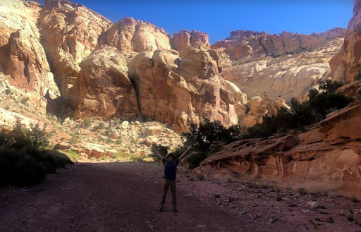
We wanted an easy hike day, and this was a 3.1 mile round trip hike.  The wash traversed a canyon that was breathtakingly gorgeous.  The canyon walls had to be 300+ feet tall and ranged from whites to reds and everything in between.  

I'm the little purple dot in the middle for scale


We were so busy looking at the scenery that we completely missed the trail cut-off for the Cassidy Arch, which we realized about 1.5 miles in.  We talked to a family and figured out we were on the Grand Wash trail and not the Arch trail.  The Grand Wash trail also had a start point at the opposite end and it was about 3 miles from one end to another (or 6 round trip). 

Obligatory jumping picture

The canyon we were in was fantastic, so we decided to keep going; one aspect of canyons that we see everywhere is all of the holes in the canyon walls – they are very common in Capitol Reef and are called “Solution Cavities” or honeycomb weathering, caused by wind, water and ice that basically erode softer areas of the sandstone leaving the harder portions intact. 


We entered “the narrows” where the walls, still towering above us, closed in.  Not to the level of a slot canyon, but happily for us, enough to provide a tremendous amount of shade for most of the hike.  At one point we happened upon a national park services guy who was staring up the canyon wall and taking pictures.  We stopped to chat (of course) and found out that he was identifying new historical graffiti.  Funny twist – if someone carves their name into a canyon wall today, they are fined $300.  If someone carved their name into the canyon a long time ago, it is preserved as a historical artifact.  This guy thought the “graffiti” was probably from the 1910-1920’s given the look of the handwriting; thus, it was being marked and preserved.

Date estimate based on seraphs in lettering

We made it almost to the opposite end of the Wash, but hit an unshaded stretch and turned back.  Overall, one of the most beautiful hikes I’ve ever been on, which ironically, was completely unplanned.  On our way back, we found the turn-out for the Cassidy Arch (named after Butch Cassidy because he had a hideout in the Grand Wash and the Arch was a guide to finding his hideout), which was another 3 miles round trip plus a 1,000-foot elevation gain in mid-day, full sun.  No thanks.  We finished our hike, found a viewpoint for the arch, thanked the lord we hadn’t hiked up it when we saw how high it was, and continued to our next hike.

Cassidy Arch is the little black dot at the top/middle

We got to the end of the scenic road and then went further into another canyon, about 2 miles on a twisty unpaved road, ultimately getting to another car park.  There was a short hike here called the Pioneer Register, a roughly 2 mile out and back hike to see more “historical graffiti” – the okay kind.  The canyon walk was nice and we saw some petroglyphs, but the big payoff was several sections of exceptionally smooth canyon wall where people from the 1800’s on carved or painted their names on the rock.  One in particular - we have no idea how they actually got to the section of rock to carve their names.

Names carved about 20' below cliff top

Names blown up

We saw a lot dated late 1800’s and early 1900’s, but they were also carved over other stuff that had to be even older.  Some of the carvings looked like bullet holes and others were so high up, we had no clue how someone could carve their names unless dangling 20-30’ off the top of a cliff.  Of course, there are always some morons who feel the need to add current carvings, thus requiring the park to put in security cameras to preserve history.

Bullet holes upper left?

We are trying to limit ourselves to 2 hikes per day and no more than 5-8 miles – mostly because it is just too hot to hike much longer into the day.  We headed back up the scenic road and encountered a lot of interesting wildlife – a reindeer and a random free-range cow just walking up the middle of the road all by itself. 


I can’t say enough about the scenery in Capitol Reef – it is hand’s down some of the best in Utah.  I couldn’t stop taking pictures – the sky is insanely blue every single day; and the backdrop with red rocks is just amazing.  Sadly, we only had one day allocated to Capitol Reef as we are still on a mission to hike a great slot canyon.  We always wondered how the government determined where to put National Park borders.  I think that question was answered as we left the designated park because almost immediately, the scenery changed, and we entered the weirdest landscape ever. 


We went from gorgeous red rocks to this bizarre totally desolate landscape that was almost creepy to drive through.  Rocks and landscape turned very gray with almost nothing of color visible.  Plus, it was averaging about 97 degrees – desert heat makes everything worse.  

Eventually we came to a small town called Hanksville, giving us about 5 minutes of cell service to try to map out camping options.  To give you an idea of how strange the landscape was, Damon realized that we were close to the Mars Desert Research Station – a place where they could simulate life on Mars.  Of course, we had to go visit it. 

Another 3-mile off road adventure – where we truly felt like we were on another planet.  


And then in the middle of all of it we saw the Mars habitat simulators. We couldn’t get too close, but it was interesting to see – especially because I recently listened to a podcast called “The Habitat” that followed a group living in a similar set up in Hawaii. 


Habitat & Greenhouse

Our final day (tomorrow) will be spent in an area near Goblin Valley State Park, which is in the middle of no-mans-land.  We took a chance and tried to find a place to camp, but everything was very exposed, windy, and crazy hot.  We went to Goblin Valley Park and they had one open camping spot left.  Despite the lure of bathrooms and showers, we opted to try to find another BLM area to camp – one gets spoiled with privacy, views, and silence.  Luckily, the park guy had told us of an area that had several BLM roads that was close by, so we tried that. 

We found an amazing spot that I dubbed the “HooDoo Hollow”.  It was completely shaded by the time we got there with an arc of tall hoodoos that blocked wind and gave us some reprieve from the sun.  

Not a great picture, but we had a half circle arc of hoodoos surrounding us

We set up camp, made dinner, stared at nature, stared at nature some more, had a close call with a low flying bat (just the one) and then went up to the tent where we stared at stars.  There have been a few times that I’ve been in a secluded and dark enough spot to be able to see the Milky Way.  This was one of those times.  I have not so awesome vision and even without my contacts in, I could see the Milky Way with my naked eye.  I put on glasses and the stars were insane.  Billions and billions and the Milky Way was so defined you could trace it across the whole sky.  Even though it was still hot outside, the temps do tend to cool down overnight, so sleep was not bad at all.  Last night in a tent!


Sunday, August 9, 2020

Day 8 - We are in Deep Water now

Woke up at 6am to some strong winds and thought it best to take the tent down as quickly as possible.  Hard to leave this spot as the view was just spectacular.  

We were packed up in a record 30 minutes and drove to the Zebra Slot Canyon trailhead, meaning, we had to go back to Hole in the Rock Road – our nemesis.  Zebra Slot was about 8 miles down the road and we were the first to get to the trailhead at 7am.  With the winds not as strong at this location, we had a quick breakfast.  Another family with 4 kids pulled in just after us and started the hike ahead of us.  

The hike was about 2.5 miles to get to the mouth of the slot  canyon – for the most part, it was level, had an easy to follow path that did not involve as much deep sand, and since we had left so early, a relatively comfortable temperature.  

Random Tumbleweed
Cool wavy stripes


It should go without saying that this time, we brought double the water and a first aid kit.  We eventually passed up the family and made it to the head of Zebra as the first hikers of the day.  I had read on-line that 4 days earlier, the slots were filled with water and people had to turn back because it was too deep; I was hoping that at least some of the water would have evaporated.  Of course, no such luck for us.

Within 10’ of the canyon opening, we could see the first pool of water followed by a little sandbar, and then more water.  That was pretty much all we could see as the narrow slots were zig-zaggy and we couldn’t see too far ahead.  We decided to go for it and see how far we could get – we knew the slots were fairly short, and that it was possible to get to the end where the cool zebra part gets its name even if there was water.  

We entered the first pool and holy hell that water was cold!  Not sure if we were supposed to take it as an omen that there were tadpoles swimming in the water next to us.  We got to the sandbar and kept going.  I made Damon go first.  He is taller.

The first section got to about waist high and then started to get shallow again to thigh high.  Good sign!  Then as we kept going, it just got deeper and deeper until the water was chest high on Damon.  


Given that we were trying to hold packs and shoes over our heads, and the fact that the water was crazy cold, we thought it most prudent to throw in the towel and head back.  By the time we got back, the family had made it.  The dad really wanted to give it a try as he had heard the end of the slot (the zebra part) was amazing.  He left everything behind and was using the walls to hold himself up, but eventually even he gave up.  The kids thoroughly enjoyed themselves catching tadpoles in Ziploc baggies, a Dorito’s bag and a cardboard animal crackers box.

The family had told us about another hike we could do to see moqui balls close by.  Disappointed by our second failed slot canyon attempt we thought, what the heck.  moqui balls are nearly perfectly spherical chunks of iron roughly the size of a golf ball and some, if not all, seem to be hollow.  They are naturally occurring and for some reason, there was a huge accumulation of them in this area. 

With a general idea of where to go, we started walking, hit a barbed wire fence, and undeterred, scampered up a rock face next to the fence (it was a cattle fence, not a property fence, so no laws broken).  We got to the top of the rock face and as far as the eye could see where these smooth white relatively flat rocks.  Way off in the distance, Damon thought he saw some balls, so we investigated.  Sure enough, balls galore.  They sort of pooled together in different areas but there were tons of them.  Mission accomplished.


My hidden talent - juggling moqui balls. 

On the way back, we tried a different route – down a 20’ rock fall as opposed to the hill and rock face.  The rock fall was narrow and just had a bunch of huge rocks that had piled up, we climbed down them for a slightly quicker retreat.  

The hike back was uneventful, and we made it back to the car spirits intact with lots of water to spare.

Our next stop was a few more miles down HITRR – Devil’s Garden.  We drove there and set up the Pterodactyl (my official name for the monster awning) and had ourselves a picnic.  The Devil’s Garden is a small area that has a concentrated grouping of large hoodoo-ish rock formations.  Really a beautiful area with several paths that wandered all through the area.  We explored for a bit, but it was mid-afternoon, so very hot, and then called it a day.


We drove back to the Escalante Visitor Center for another parking lot nap, clean bathrooms, and another hour working on the blog.  What we didn’t do with much coveted access to four bars of 4G, was figure out where we wanted to spend the night.  We had a general idea of where we wanted to be for tomorrow’s hike in Capitol Reef National Park and went in that direction.  Lucky for us, the direction was on Route 12, a national scenic highway.  Route 12 winds you through beautiful landscapes – every time you crest a hill or turn a corner, the landscape and colors change.  This is our 3rd time on Route 12 and it never disappoints.

We passed a few campgrounds that had too many people, then headed to the one we wanted to be in, but it was full, so we had to backtrack and find a BLM road we had passed earlier and hoped for the best.  On a positive note, Capitol Reef scenery is utterly stunning (more on that later); however, it was after 7pm and I was getting hangry. 

The spot we ultimately found was awesome.  Although not too far off the road so there was still some traffic noise, the view was great and generally the spot was private.  


I started making dinner and in another wonderful turn of events – no bees and because we were over 9,000 feet, it cooled down quickly.  Damon had promised me that I would never have to go more than 2 days without washing my hair and time was up.  We had brought an outdoor shower, and this was its inaugural event.  We didn’t go full shower since the body wipes are doing their thing, but I did get the most wonderful spa day in the dessert with our little shower set-up with Damon washing my hair salon style.  


Armed with a clean head and a moderately clean body, we relaxed until dark, saw an amazing array of stars – and the milky way was visible – and went to sleep.

Day 7 - Rookie Mistake

Our original plan had been an early wake up so we could get to the tire shop before it opened, but having been lulled into a wonderful slumber with air conditioning, a comfy bed and a flush toilet, we lollygagged for a few minutes too long, and by the time we got to the tire shop at 8:05, we were third in line.  We chatted with another couple from New Hampshire (Chris & Lelah) while they were getting their tire repaired as they, too, had blown it on Hole in the Tire Road yesterday.  We left our tire and went to eat breakfast and when we came back to the shop an hour later, there were four more cars in line with blown out tires – clearly, that road keeps these guys in business.  They couldn’t fix our tire – something had carved a z-shaped gash in the tread and it was DOA.  Luckily, they had a used tire that fit our car and for a mere $57, we were on our way.

The hike we had planned to do, Big Horn Slot Canyon, has two different entry points – one from the bottom from HITRR and one from the top from Old Sheffield Road.  We had heard that the Old Sheffield Road route might be a little shorter, and since we lost 2 hours in tire repairs and the day was heating up quickly, we opted for the Southern Route.  The drive on Old Sheffield’s rocky unpaved road was only 3 miles from the main road, and en route, we saw some amazing potential camp sites for the night.

We pulled into the “parking area”, which was a tiny grassy area the width of two cars.  There was one car already there, so we took the second spot and started on our hike.  The path was easy to follow – it was mostly through a dry riverbed (The Harris Wash) and we were able to follow the footprints of the two people who were ahead of us.  

The hike was about 2.5 miles to the slot canyon and it was mostly deep sand (like on a beach) and rocks.  We tried to stay on the rocks as much as possible, but the vast majority was sand.  We played tracker and got excited every time we saw footsteps since that meant we were going in the right direction.  Truth be told, getting lost while following a riverbed is difficult, but I wouldn’t put it past us.  The sun was in full force and it was hot out, but that did not deter us.  Nor did coming across a 60’ drop in the riverbed.  Yes, it was literally a 60’ drop.  The Google stuff I read said that this was a “moderately easy” hike and I’m thinking – a 60’ cliff is a moderately easy hike?  There was some swearing in there, too.  Google also said that there was an easy way around the drop to the left.  The easy way around was like a 70-degree angle instead of a 90-degree angle of mostly slick rock.

Damon went first and I followed crab walking down on my butt.  I’m too old for this shit.  No, I’m not – it was kind of fun once I got to the bottom.  


Eventually we got to the mouth of the slot canyon with another big drop, but this time it was skinny, and we weren’t sure we could get back up, so we started exploring the top of the slot.  

Hard to tell, but that is about a 12-15' drop to the bottom

Looking down - we didn't think we could get back up without ropes

Side note – the primary reason we had initially chosen the HITRR start point was because as you approached from that direction, you went through the best/easy slots and then they got progressively harder until you had to turn back because it got too technical and required climbing skills and ropes.  Well, that would be where we popped into the slot and we are most definitely not technical climbers.

We investigated around and popped in and out for part of it and eventually we heard voices.  We were so excited to meet “the footprints” that we had been following.  Go figure – it was Chris and Lelah from the tire repair shop!  They said that they had been exploring in and out of the slots farther up like us, but determined it was too technical and didn’t get in very far.  Sadly, that meant the end of this exploratory endeavor and after hunkering in a slot crevasse for a snack, we headed back. 


Now let’s talk about what the Utah dessert feels like around noon when there is no shade and you are walking in ankle deep sand.  It is pure flipping torture.  We were sucking down water like crazy and stopping whenever we could find a bush or scrap of shade.  It was brutal.  There was a point where I was ready to lay down and declare “save yourself, just leave me here to die”, but we soldiered on.  When we came to that 60’ wall and had to climb up, I had some crazy burst of energy and while Damon was still mapping his route up the slick rock, I ran up it and he was like WTF??? 

At one point, we stopped for a water break and I kept telling Damon to open the water flow and in the most amateur hiking move ever, we realized we had run out of water.  In our Kaibab Hike, we had gone through half the amount of water in the same distance.  We got very lucky in that we were only about 5-10 minutes from the car, but it was such a rookie mistake, we were horrified.  We got back to the car and each drank a huge bottle of water, followed by a huge bottle of Gatorade, followed by more water.  My fitbit registered an average heart rate of 124 bpm on the way back – we were walking!  Probably one of the hottest hikes I’ve ever done.  No pictures from the way back, but one bonus scenery shot from the way out while we were still smiling.

Post walk, we drove to our Escalante Oasis, aka, the Escalante Visitor Center, which although closed, does offer a cell signal, clean air-conditioned bathrooms, and some nice shaded benches.  We parked in the lot, opened the car windows, and promptly fell asleep – both of us.  After a quick nap, we put together our picnic and had lunch and sat there for about 2 hours while I worked on the blog 😊

Around 4:30 or so, we went back to Old Sheffield Road to find the campsite we had identified earlier and set up camp.  It was Damon’s dream site – no one anywhere around, the view was spectacular, and we had enough time to just hang out, relax, and stare at nature.  


Around 7 we started dinner and again, we were aggravated by a pesky bee, which, was a yellow jacket (wasp family, mean little buggers, can sting multiple times).  Damon killed it just as we plated dinner and within about 20 seconds, we had about 5-10 more yellow jackets swarming our food.  We tried killing them, got a few, but more just kept coming, so we ran into the car and had a lovely dinner sitting in the front seat of the car.  Once the food was gone, the bees had no further use of us and disappeared.  I had no idea yellow jackets like chicken and peppers as much as they seem to like tacos!

Went to sleep around 10 with a plan to get up early so we could start our next hike before the crazy heat kicked in.

Sunset and our fancy tent lights